Alexandria Louisiana WWII Military Camps
|
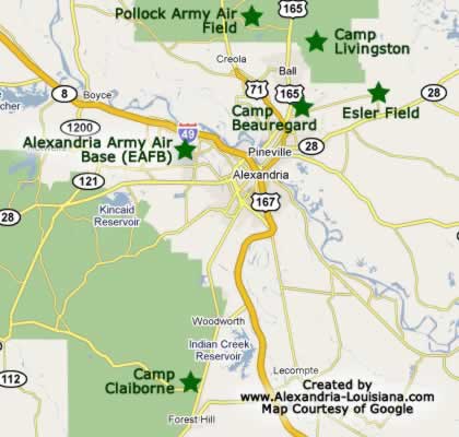
Alexandria and Central Louisiana were the center of a massive military build-up prior to, and during, World War II. The map below depicts the locations of major military installations during the war near Alexandria.
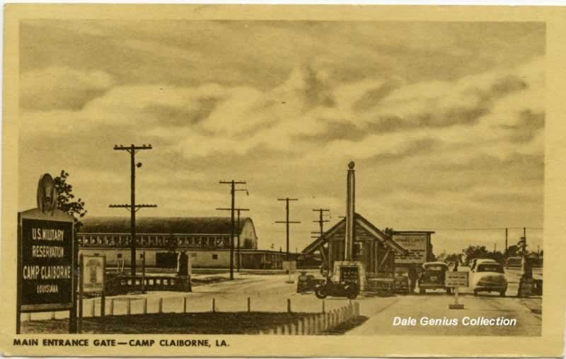
Camp Claiborne was situated in Rapides Parish about 18 miles south of Alexandria, off the intersection of US Highway 165 and present day La Highway 112, just north of the town of Forest Hill.
We remember driving the abandoned roads of the camp and stopping to shoot BB guns into some of the abandoned warehouses during the late 1950s.
We remain fascinated by the history of this camp, and have total respect for the men and women that served there.
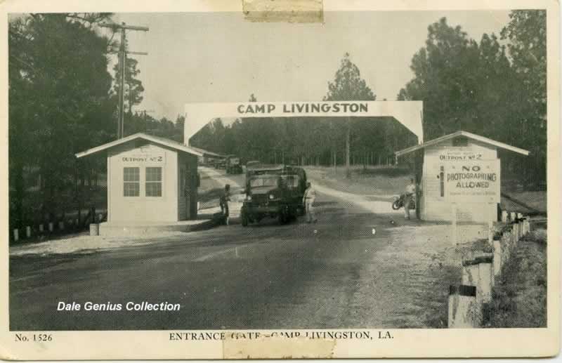
The other major area Army facility, Camp Livingston, was northeast of Alexandria.
Other Alexandria area military facilities included Alexandria Army Air Base, Camp Beauregard, Esler Field, and Pollock Army Air Field, as shown in the map to the right. Camp Polk was located further west of Alexandria near Leesville.
 |
|
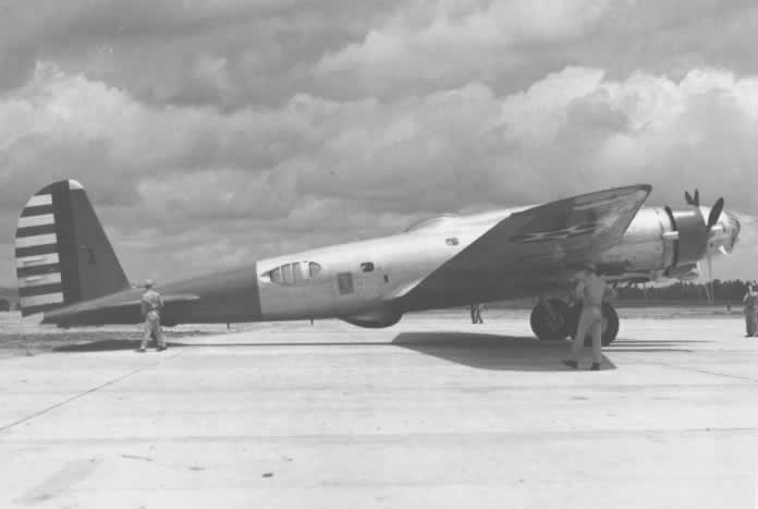
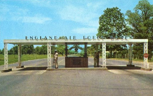
Alexandria Army Air Base Later England Air Force Base |
 |
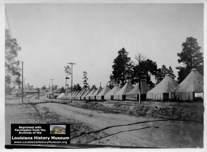
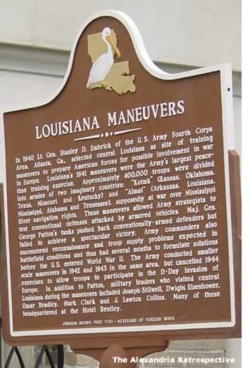
Camp Livingston, active during 1940-1945, occupied about 47,000 acres east of Alexandria and was a key element in the Louisiana Maneuvers.
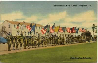 |
It was originally named Camp Tioga, but later renamed in honor of Chancellor Robert R. Livingston, a negotiator involved in the Louisiana Purchase.
Thousands of troops were based at the camp, which also included a POW facility.
Camp Claiborne, west of Alexandria, was originally created on June 10, 1930 as Camp Evangeline, for the "Evangeline District" of the Kisatchie National Forest.
Later, it was later renamed for William C.C. Claiborne, the Governor of the Territory of Orleans and first governor of the State of Louisiana.
In 1939 construction crews began to expand the camp for its reactivation as a U.S. Army camp during 1940. It included 30,176 acres.
Camp Beauregard served as a training facility for soldiers who were sent to France from 1917 to 1918 and was closed in 1919 and turned over to the State of Louisiana which used the grounds periodically for National Guard training.
It was reactivated as a federal facility in 1940 and served as the hub of the Louisiana Maneuvers.
Esler Field was also known as Camp Beauregard Army Field, and Esler Army Airfield. Construction began in 1939, and renamed in 1941 to honor Lt. Wyler Esler, a pilot who was the first casualty of the airfield when his plane crashed on April 11, 1941.
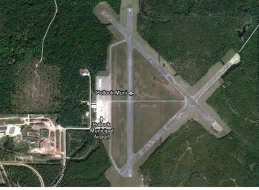
Pollock Army Air Field was located 4 miles southwest of Pollock, Louisiana, and was a satellite air field for Alexandria Army Air Base (later England AFB). It featured three paved runways forming a triangle, and was turned over to civilian control after the war and renamed Pollock Municipal Airport.
This website has collected numerous historic postcards, photographs, maps, newspaper stories and other information on several military installations in the area.
These artifacts from the past tell amazing stories of the magnitude of the camps, and lives of the people who served there.
We remain fascinated by the history of these camps and air bases, and have total respect for the men and women that served and their part in achieving peace for the United States.
|
Other Sources of Military Camp Information
Several other sites have significant information about these military camps, including:
WikiPedia Articles: Camp Livingston and Camp Claiborne
The National World War II Museum, New Orleans
Louisiana History Museum, Alexandria, Louisiana
32nd Infantry Red Arrow Division Veteran Association

